Sample answer 1
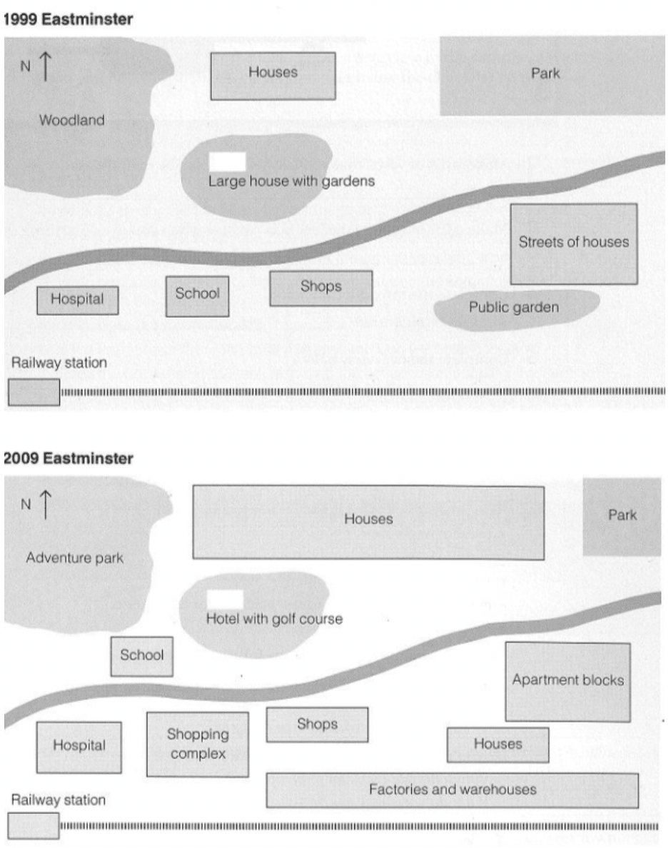
The maps give information about how a village called Eastminster changed during a ten-year period.
Overall, the Village underwent residential and commercial developments with less open spaces over the decade.
Looking first at the area to the North of the river, the Woodland in the north-west was turned into an adventure park while the park in the North East of the town became much smaller in size. It is clear that the park in the north-east gave way to the expansion of houses which were originally smaller in size compared to those of ten years ago. Moreover, the large house with gardens was replaced with a hotel and the golf course. The other main development to the north of the river was the relocation of the school from the South bank of the river.
The area south of the river experienced greater changes. To the east, the streets of houses were demolished to make ways for blocks of flats. Besides, the area to the south west of the old streets of houses, which was originally a public garden, had more houses built. Further developments that occurred where the construction of factories and warehouses, line together with the conversion of the school on the river into a new shopping complex. The final transformation was the expansion of the hospital west of the old school situated by the river.
Word count: 229 words